Density Altitude and Aircraft Performance
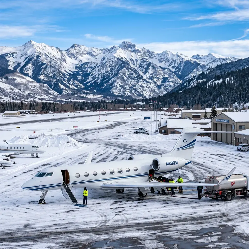
Density altitude is the altitude at which the aircraft 'thinks' it is flying based on air density. At a mountain airport on a hot afternoon, density altitude can exceed the field elevation by 2,000 to 3,000 feet. An aircraft at Aspen (7,820 feet field elevation) on a 90-degree day operates at a density altitude above 10,000 feet. At that altitude, engines produce approximately 25 to 30% less thrust than at sea level. Wings generate correspondingly less lift. Takeoff rolls lengthen. Climb rates decrease. Service ceilings feel closer.
Pilots compute takeoff and landing performance for every mountain airport departure using actual temperature, pressure altitude, wind, and aircraft weight. The result determines whether the departure is possible within the available runway length with required safety margins. Some departures that are legal and safe in the morning become impossible by early afternoon as temperatures rise. Operators schedule mountain airport flights for morning hours whenever possible to take advantage of cooler temperatures and calmer winds.
Passenger impact is direct. On hot summer days, operators may restrict passenger count or baggage weight on departures from high-elevation airports. A Challenger 350 that carries 9 passengers from Teterboro may be limited to 7 passengers departing from Aspen on a warm day. The operator communicates these restrictions before the flight, but passengers should be aware that mountain departures may involve payload limitations that sea-level airports do not impose.
Terrain Awareness and Approach Procedures
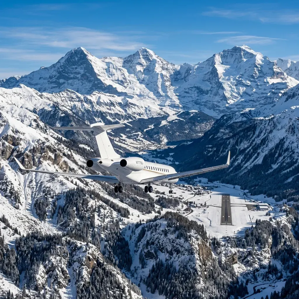
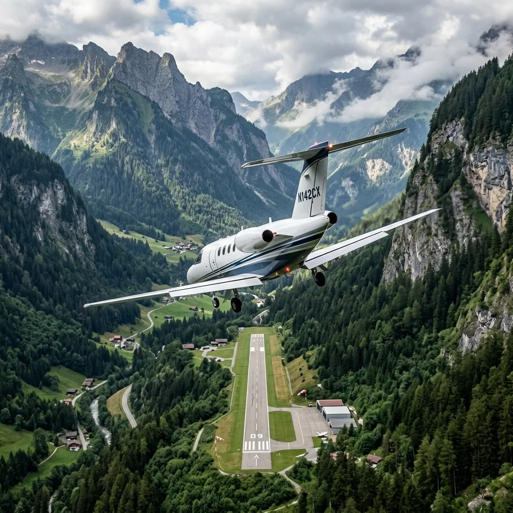
Mountain airports are surrounded by terrain that rises above the airport elevation. This creates approach and departure corridors that restrict the angles and directions from which aircraft can safely arrive or depart. Aspen's approach funnels aircraft through the Roaring Fork Valley. Telluride's approach threads between peaks that rise to 14,000 feet. Jackson Hole's Runway 19 approach requires visual contact with terrain references that are obscured in low visibility conditions.
Instrument approaches at mountain airports typically have higher minimum descent altitudes than sea-level airports. An ILS approach at Teterboro might allow descent to 200 feet above the runway. A GPS approach at Aspen requires visual contact at 1,500 feet or more above the runway. If the weather is below those minimums, the aircraft cannot land. Passengers should understand that mountain airport operations have lower weather tolerance than flatland airports. A flight that would land easily in New York might divert from Aspen due to identical cloud ceilings.
Terrain Awareness and Warning Systems (TAWS) and Enhanced Ground Proximity Warning Systems (EGPWS) are mandatory equipment for mountain operations. These systems provide visual and aural alerts when an aircraft approaches terrain. Modern glass cockpit displays show synthetic terrain on approach, giving pilots a 3D visualization of the surrounding mountains even in instrument conditions. Pilots operating into mountain airports must hold specific training endorsements and maintain currency requirements that do not apply to flatland operations.
Mountain Airport Charters
Experienced operators, proper equipment, morning scheduling. We coordinate the details.
Request a Quote →Weather Patterns Unique to Mountain Flying
Mountain weather is locally generated and rapidly changing. Orographic lifting occurs when moist air is forced upward by mountain terrain, creating clouds, turbulence, and precipitation on the windward side of mountain ranges. Afternoon thunderstorms develop over mountain peaks with regularity during summer months. These storms can produce severe turbulence, wind shear, and microbursts in the vicinity of mountain airports. Morning flights avoid the worst of convective activity.
Mountain wave turbulence is an invisible hazard that occurs when strong winds flow over mountain ridges. The resulting wave patterns can produce smooth laminar flow at some altitudes and severe turbulence at others. Mountain wave can affect aircraft at FL300 and above, well above the mountain peaks themselves. Pilots use pilot reports (PIREPs), aviation weather charts, and forecast models to identify mountain wave activity before departure. Routing adjustments can avoid the worst turbulence zones.
The most common mountain airport delay is weather-related. A charter to Aspen during ski season should include a backup plan: if Aspen weather is below minimums, can the aircraft divert to Eagle County (40 miles west, lower elevation, better approaches) with ground transportation arranged to Aspen? Building a divert plan is standard procedure for mountain airport operations.
Notable Mountain Airports for Private Aviation
Telluride at 9,070 feet is the highest commercial airport in the United States. Its 7,111-foot runway limits aircraft size for most operations. Large-cabin jets like the Gulfstream G650 can operate at Telluride but with significant payload restrictions. Most operators recommend light jets or turboprops for Telluride operations. The airport has no instrument approach procedure, meaning it is VFR-only. If clouds obscure the valley, the airport closes.
Jackson Hole presents a different challenge: a relatively short runway (6,300 feet) combined with 6,451 feet of elevation. The combination limits heavy jet operations more severely than airports with longer runways at similar elevations. The runway has been a topic of expansion discussion for decades, but environmental and community concerns have prevented lengthening. Aircraft that operate comfortably at Eagle County (9,000-foot runway) may be payload-restricted or unable to operate at Jackson Hole. Additionally, the airport is located within Grand Teton National Park, which necessitates specific noise-abatement procedures and strict adherence to defined arrival and departure flight paths to protect local wildlife and the visitor experience.
Sun Valley's Friedman Memorial Airport (SUN) presents yet another scenario. At 5,318 feet elevation with a 6,602-foot runway, it falls in between the extreme-altitude airports. However, its approach procedures are limited and terrain obstructions on multiple sides restrict departure routing. The airport's proximity to the town of Hailey creates noise-sensitivity issues that have led to voluntary flight restrictions. Heavy jet operations are possible but require experienced crews familiar with the specific procedures and terrain environment.
For passengers, the practical impact is aircraft selection. Mountain airport charters should be planned with the specific airport's constraints in mind. A PC-12 or TBM 960 that operates without restriction at any mountain airport may be a better choice than a midsize jet that requires payload limitations. Operators experienced in mountain flying can recommend the optimal aircraft type for each specific airport and season, balancing cabin comfort against operational capability.