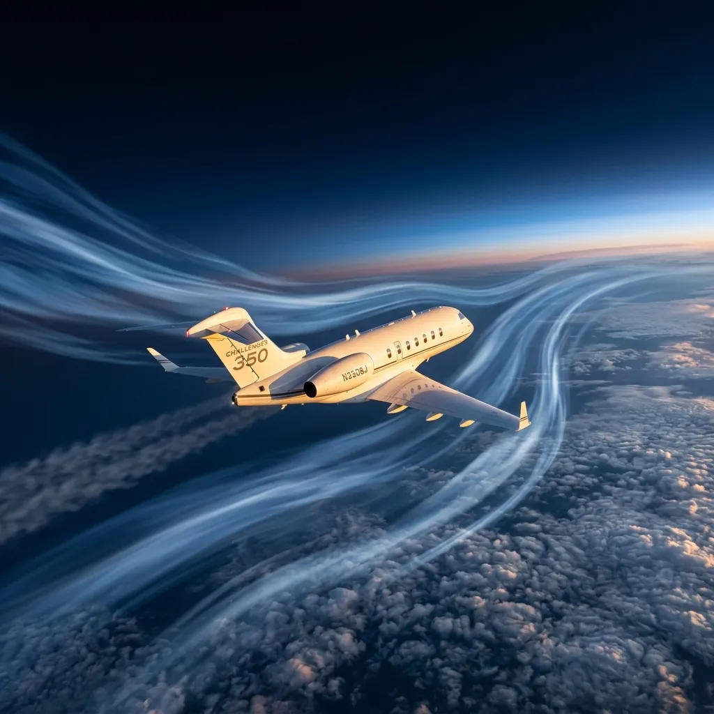
High-altitude winds visualized above a business jet cruising at flight level 450

Winds Aloft: The Hidden Variable in Every Charter Quote

A Challenger 350 flying New York to Los Angeles at FL 430 in January encounters headwinds averaging 120 knots. The same aircraft on the same route in July faces 40-knot headwinds. That 80-knot difference adds roughly 55 minutes of flight time and $4,500 in hourly charter costs. The variable is winds aloft, and every charter quote you receive is built on a wind forecast.

In This Article

What Winds Aloft Actually Means How to Read an FB Winds Aloft Forecast Seasonal Jet Stream Patterns Over the United States Eastbound vs Westbound: The Asymmetry in Every Quote Altitude Selection: Trading Wind for Speed How Operators Build Wind Into Charter Quotes Turbulence, CAT, and the Jet Stream Boundary Frequently Asked Questions

What Winds Aloft Actually Means

The National Weather Service Aviation Weather Center publishes Winds and Temperatures Aloft Forecasts (FB products) every six hours. These forecasts report wind direction, wind speed, and temperature at nine altitude levels from 3,000 feet to 53,000 feet (FL 530) for 176 stations across the continental United States. Every Part 135 charter operator and every corporate flight department uses these forecasts to build flight plans. The data determines route selection, cruise altitude, fuel load, and ultimately the flight time that appears on your charter quote.

At the altitudes where business jets cruise, between FL 350 and FL 510, wind speeds routinely exceed 100 knots. That is not a gust or an anomaly. It is a persistent atmospheric feature called the polar jet stream, a narrow band of high-speed westerly winds that circles the Northern Hemisphere at roughly 30,000 to 40,000 feet. The jet stream exists because of temperature gradients between polar and tropical air masses. It flows from west to east, which means every eastbound flight gets a push and every westbound flight fights a wall.

A 100-knot headwind at FL 400 reduces a jet's groundspeed by 100 knots. On a Challenger 350 cruising at Mach 0.80 (460 knots true airspeed), that cuts groundspeed from 460 to 360 knots. The same 100-knot wind as a tailwind increases groundspeed to 560 knots. The difference between eastbound and westbound flight time on the same route can exceed 90 minutes.

How to Read an FB Winds Aloft Forecast

An FB winds aloft report uses a compressed six-digit code. The code 2714+03 at FL 390 means: wind from 270 degrees (due west) at 14 knots, temperature minus 03 degrees Celsius. When wind speed exceeds 99 knots, the format changes. A code of 731960 at FL 390 means: wind from 230 degrees at 119 knots, temperature minus 60 Celsius. The encoding subtracts 50 from the direction prefix and adds 100 to the speed. Pilots and dispatchers decode this instantly. Charter clients do not need to read FB products, but understanding the system explains why your broker quotes different flight times for the same route at different times of year.

The Aviation Weather Center issues three FB forecast periods: 6-hour, 12-hour, and 24-hour. Dispatch teams use the 6-hour product for same-day flight planning and the 12-hour product for next-day trips. The 24-hour forecast drives preliminary fuel planning for flights booked 48 hours in advance. Accuracy degrades beyond 12 hours, which is why your final flight time confirmation often comes the morning of departure.

Seasonal Jet Stream Patterns Over the United States

The jet stream is not static. It migrates north and south with the seasons and strengthens or weakens based on the temperature differential between polar and subtropical air. In winter (December through February), the polar jet stream descends to approximately 30-35 degrees north latitude, placing it directly over the most trafficked domestic charter corridors: New York to Los Angeles, Chicago to Miami, and Teterboro to Scottsdale. Winter jet stream speeds routinely reach 150-200 knots at the core, with 100-130 knots common at FL 390-FL 430.

In summer (June through August), the jet stream retreats north to 45-50 degrees latitude, roughly along the Canadian border. Wind speeds at the core drop to 60-90 knots. The practical effect is dramatic: a transcontinental westbound flight that takes 5 hours 40 minutes in January may take only 5 hours 05 minutes in July. That 35-minute difference translates to roughly $3,000-$4,000 in hourly charter savings on a super-midsize jet.

Spring and fall present the most variable conditions. The jet stream is transitioning, and its position can shift 500 miles north or south within a single week. Dispatch teams monitor these transitions closely because a route that worked well on Tuesday may require significantly more fuel on Friday. March and November are particularly unpredictable.

Eastbound vs Westbound: The Asymmetry in Every Quote

Charter pricing is built on flight hours. An operator quoting $5,500 per hour for a Challenger 350 multiplies that rate by the estimated flight time, then adds positioning, landing fees, and crew overnight if applicable. When winds add 45 minutes to a westbound transcontinental flight, the hourly charge adds $4,125 to the trip cost. The return eastbound flight, shortened by 30 minutes of tailwind, saves $2,750. The net effect: a round trip is not simply double the one-way cost. The westbound leg subsidizes the eastbound leg in winter.

Fuel burn compounds the cost asymmetry. A jet fighting a 120-knot headwind burns fuel for 5 hours 40 minutes instead of 4 hours 15 minutes. At 230 gallons per hour for a Challenger 350, that is an additional 325 gallons, roughly $2,100 in fuel at $6.50 per gallon. The total wind penalty on a winter KTEB-to-KLAX flight, combining hourly rate and additional fuel, approaches $10,000 compared to the same flight in July.

Need a Charter Quote?

Contact our team for a personalized quote.

Get a Quote

Altitude Selection: Trading Wind for Speed

Dispatchers do not always file at the aircraft's optimal cruise altitude. If the jet stream core sits at FL 390 with 160-knot winds, a westbound flight might file at FL 430 or FL 450, where winds may be 30-40 knots lighter. The tradeoff: higher altitudes have thinner air, which increases true airspeed slightly but also reduces engine efficiency on some airframe-engine combinations. The dispatcher's job is to find the altitude where the net groundspeed is highest for the fuel available.

Eastbound flights do the opposite. If the jet stream core is at FL 370 with 150-knot tailwinds, the dispatcher files at FL 370 to ride the peak velocity, even if the aircraft would burn slightly less fuel per hour at FL 430. A groundspeed of 610 knots at FL 370 beats 540 knots at FL 430 on every metric. This tactical altitude selection is invisible to passengers but accounts for 15-25 minutes of flight time on transcontinental routes.

An experienced dispatcher will sometimes file a step-climb plan: cruise at FL 370 through the jet stream tailwind zone, then climb to FL 430 once past the core. This technique captures the benefit of tailwinds early and optimizes fuel burn for the remainder. It is routine in corporate flight departments and Part 135 operations but rarely discussed in charter marketing.

How Operators Build Wind Into Charter Quotes

When a charter broker requests a quote for a specific route and date, the operator's dispatch team pulls the current FB winds aloft forecast and runs the flight plan through their planning software (ForeFlight Dispatch, APG, or Jeppesen). The software calculates groundspeed, fuel burn, and flight time at multiple altitude options and selects the optimal routing. The resulting flight time drives the quote. This is why a quote for the same route can vary by $3,000-$8,000 depending on whether you are flying in January or July.

Some operators quote based on historical average flight times for a given route. This simplifies quoting but creates risk: if the actual wind is worse than the average, the operator absorbs the cost. If the wind is better, the client pays for time not flown. Most reputable Part 135 operators quote based on the actual forecast for the departure date and settle the invoice on actual block time (wheels up to wheels down). This protects both parties and is the standard practice among ARGUS and Wyvern-rated operators.

  • Ask whether you are quoted on forecast or historical flight times
  • Confirm whether billing is based on estimated or actual block time
  • Request the flight plan if wind-sensitive: it shows the forecast winds used
  • On westbound winter flights, budget 10-15% above the quoted price for wind contingency
  • For time-critical arrivals, factor headwind into your ground schedule

Turbulence, CAT, and the Jet Stream Boundary

Clear Air Turbulence (CAT) is most common at the edges of the jet stream, where wind speed changes rapidly over short distances (wind shear). Pilots receiving SIGMET advisories for CAT along the jet stream boundary may deviate laterally or vertically to avoid the turbulence zone. These deviations add distance and time. A 50-mile lateral deviation to avoid a CAT zone adds 5-8 minutes to flight time. A vertical deviation to a less turbulent but windier altitude may add more.

Winter months produce more frequent and more intense CAT events because the jet stream is stronger and the temperature gradients are sharper. Business jets equipped with predictive turbulence detection systems (Honeywell IntuVue or Collins WXR-2100) can identify CAT corridors 60-80 miles ahead, allowing crews to request altitude changes before passengers feel the effects. This technology is standard on new production Gulfstreams, Globals, and Challengers but may not be present on older charter aircraft. Passengers who are particularly sensitive to turbulence should request aircraft equipped with predictive turbulence systems, especially for winter transcontinental flights.

Brian Galvan

Written By

Brian Galvan

Founder, The Jet Finder · Private Aviation Operations & Technology

Former Director of Technology at FlyUSA (Inc. 5000 fastest-growing private jet company). Decade of hands-on experience across Part 135 operations, charter sales, fleet management, and aviation data systems.

LinkedInRead Full Profile →
Common Questions

Frequently Asked Questions


6 questions about winds aloft and charter flight planning

Upper-level winds flow predominantly west to east across the United States. Eastbound flights receive a tailwind that increases groundspeed, while westbound flights fight a headwind that reduces it. The difference can exceed 90 minutes on transcontinental routes in winter. Charter pricing is based on flight hours, so the westbound leg costs more than the return.

December through February produce the strongest jet stream winds over the continental United States. The polar jet stream descends to 30-35 degrees north latitude and accelerates to 150-200 knots at the core. January is typically the peak month. A KTEB to KLAX flight in January may cost $7,000-$10,000 more than the same flight in July due to additional flight time and fuel burn.

The first two digits encode wind direction (multiply by 10 for degrees), the next two encode speed in knots, and the last two encode temperature in Celsius. When speed exceeds 99 knots, 50 is added to the direction digits and 100 is added to the speed value. The code 731960 means wind from 230 degrees at 119 knots, temperature minus 60 Celsius. Charter clients do not need to read these reports; dispatch teams handle forecast interpretation.

Yes. Dispatchers routinely file at altitudes above or below the jet stream core to reduce headwind exposure. If the core sits at FL 390 with 160-knot winds, filing at FL 450 might encounter only 110-120 knots. The tradeoff involves fuel efficiency at higher altitudes and available RVSM flight levels. Step-climb plans that change altitude mid-route are a common technique for optimizing groundspeed across wind zones.

If your operator bills on actual block time (wheels up to wheels down), yes. A quote based on forecast winds may differ from actuals by 5-15 minutes in either direction. Reputable Part 135 operators bill on actuals, which protects you if winds are favorable and costs slightly more if headwinds exceed the forecast. Ask your broker whether billing is on estimated or actual block time before confirming the charter.

CAT forms at the jet stream boundaries where wind speed changes sharply. It is invisible to radar and more frequent in winter when the jet stream is strongest. Pilots may deviate laterally or vertically to avoid CAT zones, adding 5-15 minutes of flight time. Aircraft equipped with predictive turbulence detection (Honeywell IntuVue, Collins WXR-2100) can identify and avoid CAT corridors 60-80 miles ahead. Request equipped aircraft for winter transcontinental routes.

Continue Reading

Related Articles


Your Next Mission

Ready to Fly?


Whether you need a charter quote or want to explore aircraft options, our team is here.

Contact Us